Categories
Images
Heading
IMS4 Radar Studio | Application Software
Section 1
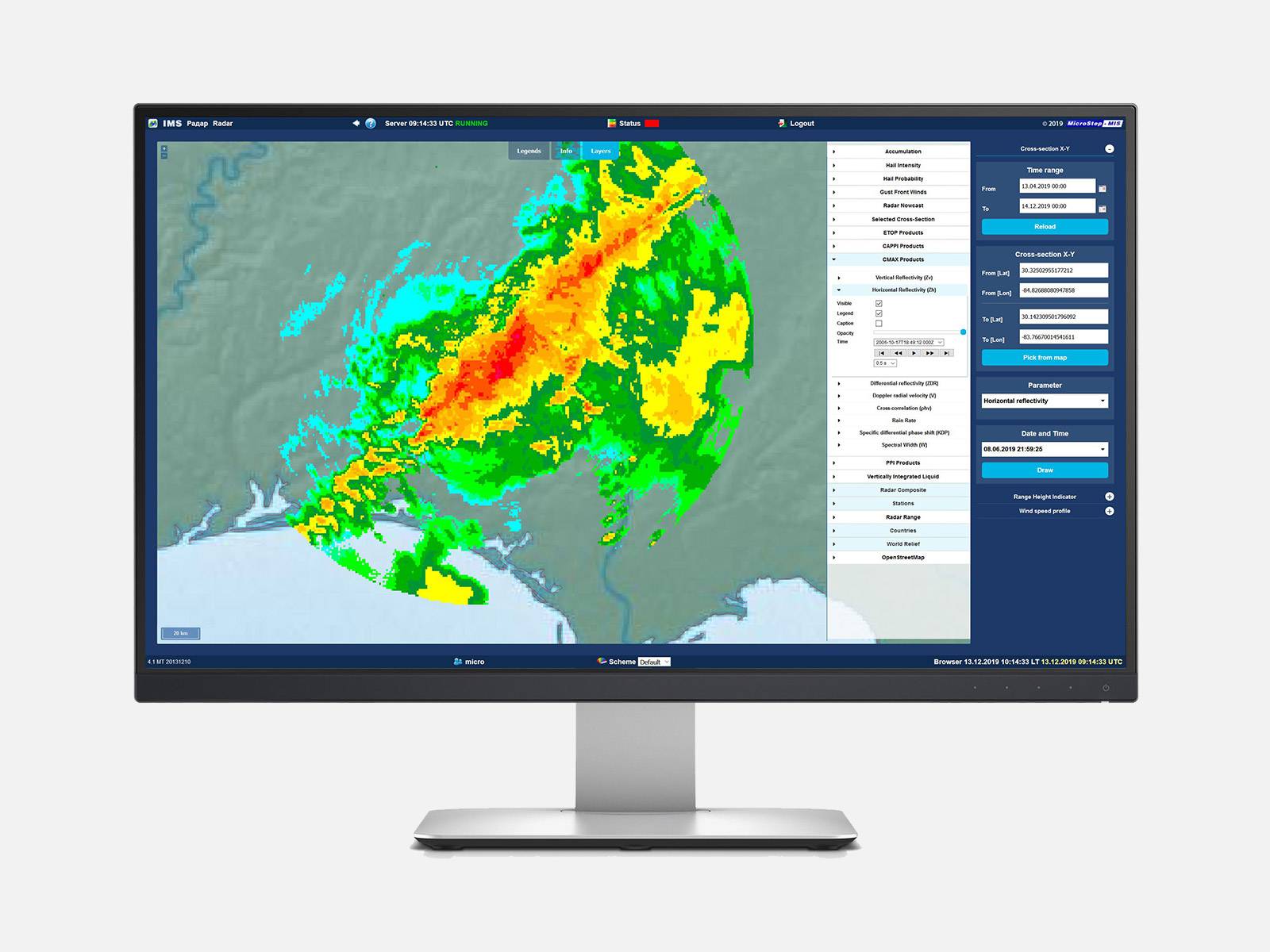
IMS4 Radar Studio is a unique tool for processing, analyzing, and graphic presentation of radar and lidar data from standalone devices up to multi-radar networks.
Benefiting from 30 years of MicroStep-MIS experience in weather data processing, the IMS4 Radar Studio provides meteorologists, hydrologists, aviation users, and researchers with functionality starting from radar data collection, analysis, product generation up to the weather monitoring, nowcasting, and detection of hazardous phenomena, and issuing early warnings.
- Coupled with MicroStep-MIS MMR radar or integrated with the 3rd party X/C/S-band weather radars, Doppler lidars, satellite imagery, weather station data, lightning data
- Support of different radar/lidar scanning strategies
- BUFR, GRIB, HDF5, OPERA ODIM, NetCDF, UF, etc. data formats
- Image export to GIF, GeoTiff, PNG, JPG, KML/Google Earth, etc.
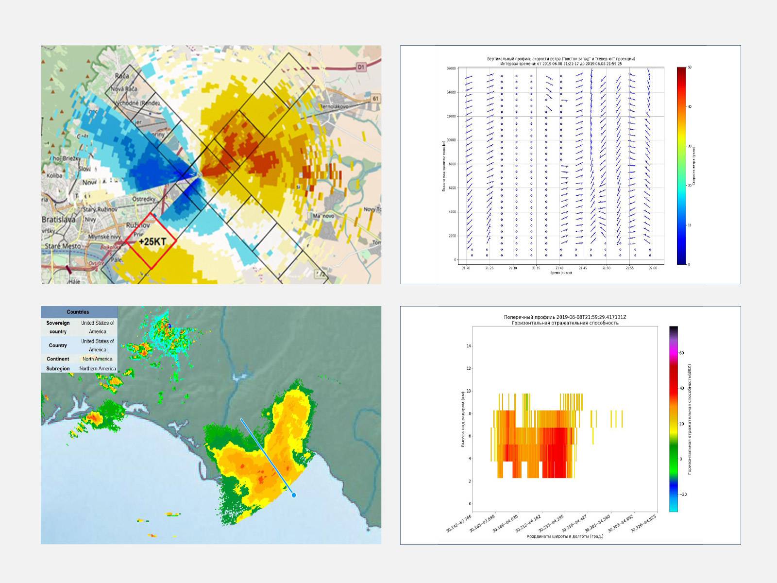
- Intelligent feature detection algorithms to identify microburst and/or gust front:
- Image recognition algorithm with the DBZH Storm Cell test
- Shear-based algorithm with the VIL test
- Weather radar data export to ATC Console (ASTERIX CAT 008, 009)
- TITAN compatibility (www.ral.ucar.edu)
- Integration with other IMS4 products:
- IMS4 Automated Weather Observation System (AWOS)
- IMS4 Low Level Windshear Alert System (LLWAS)
- IMS4 Maps: radar products via OGC Web Map Service
- IMS4 Weather Studio
- IMS4 Model Suite: integration with the Flash Flood models
- Embedded application/web server
- Multi-language support (EN, RU, FR, …)
- Certified for civil aviation use
Unique name in URL
ims4_radar_studio
Related products
Datasheets
Description
IMS4 Radar Studio is a unique tool for processing, analyzing and graphic presentation of the radar and lidar data from standalone devices up to multi-radar networks.