Knowledge about the water stored in snow has always been of interest of many hydrologists, scientists and managers. Melting snow is not just the water under the bridge, it poses a potential but also a risk. However, getting reliable and up to date information on the snow - the dynamic and the runoff nowcast as well as the forecast - is both, tricky and very costly.
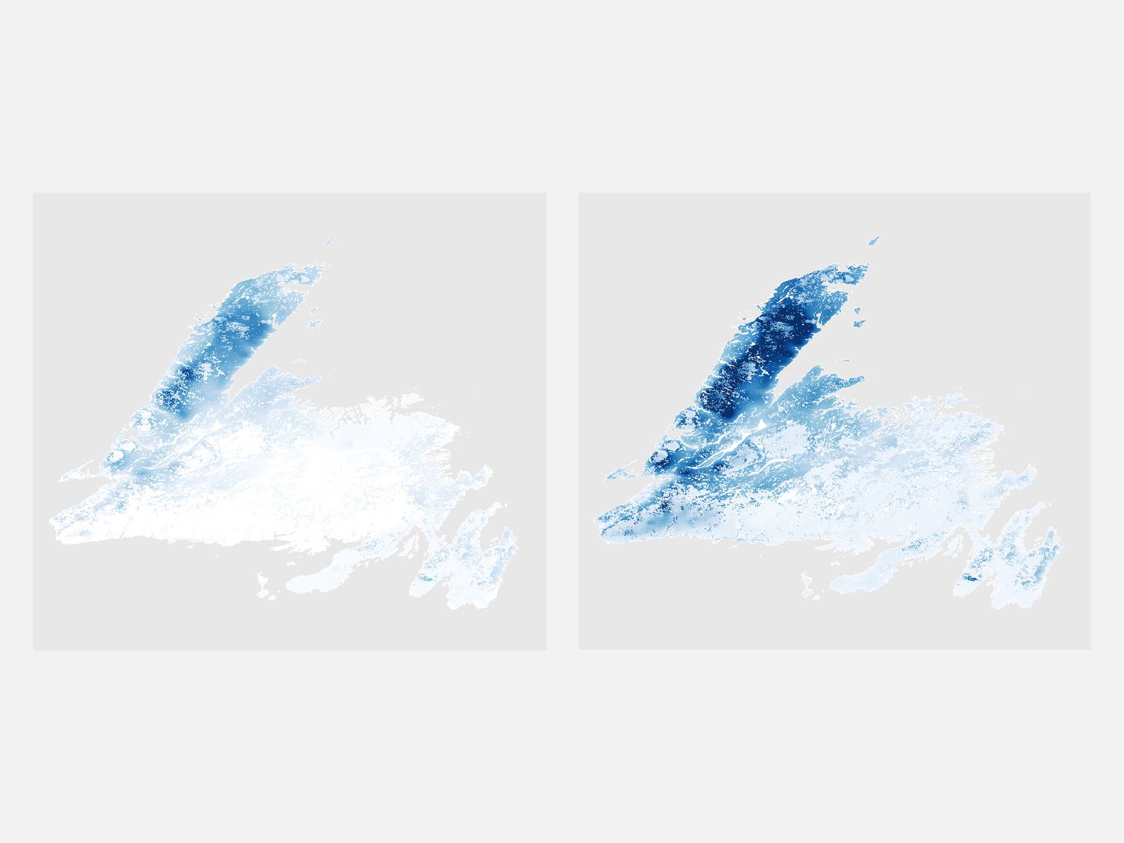
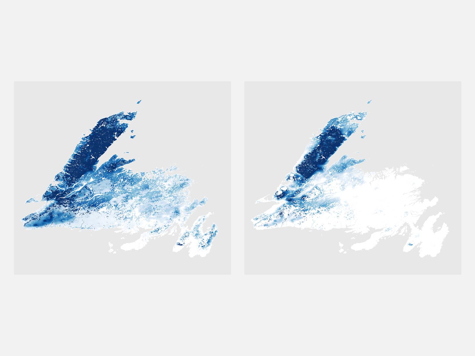
SnowSense integrates a novel measurement method using GNSS / GPS signals and versatile stations together with physical based snow and water balance modeling. Support by spatial satellite observations (e.g. from European Sentinel Satellites), the spatial information on the snow cover and the relevant parameters, such as the snow water equivalent, can be given for the entire catchment.
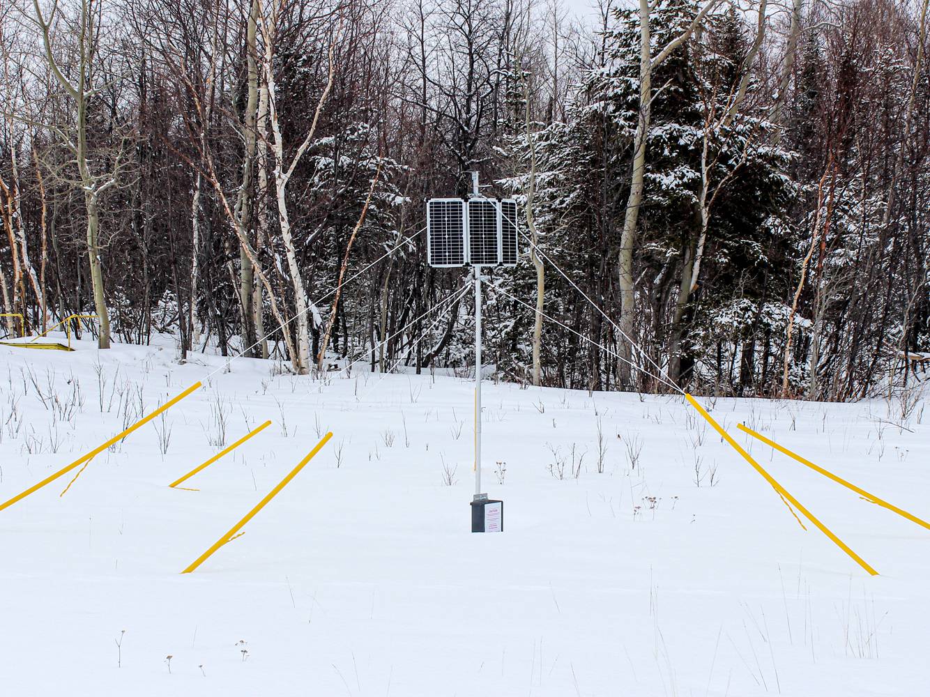
The SnowSense sensor consisting of small and maintenance free hardware (just two small antennas and a electronic box), is able to provide the snow water equivalent several times a day – also from the remote locations. Combined with the model, a full service including the provision of snow maps, runoff assessment and forecasts can be provided. Due to its modularity, the SnowSense solution can be integrated to already existing and installed measurement and forecast system.